Lingering Bay Area, Central Coast showers giving way to stronger storm, colder temps, more local snow

By Carlos E. Castañeda
The latest in a series of Northern California storms is bringing scattered showers across a frigid Bay Area and Central Coast ahead of a much stronger storm system with even colder temperatures and additional local snow.
The National Weather Service said Wednesday that showers will continue across the region Wednesday afternoon and into the evening, but widespread moderate to heavy rain will begin in the evening and continue overnight into Thursday. In its forecast discussion, the Weather Service’s San Francisco office said that periods of showers, low‑elevation snow in the hills, and much colder-than-normal temperatures will continue through the end of the week.
KPIX First Alert Weather: Current conditions, alerts, maps for your area
Temperatures on Wednesday were running about 10 to 15 degrees colder than a typical February day, with most low‑elevation spots stuck in the 40s and low 50s, while higher terrains saw temperatures in the 20s and 30s.
Snow has been falling on the highest peaks in the region, including the North Bay mountains, the Santa Cruz Mountains, the Eastern Santa Clara hills, and the Santa Lucia Range, the Weather Service said. The snow levels are currently hovering down to about 2,000 to 2,500 feet, and people traveling through the mountains could encounter slick or icy roads. Drivers heading over passes into the Salinas Valley, the interior hills of Monterey County, or along higher stretches of Highway 101 and 152 should be prepared for winter‑like conditions and slower travel.
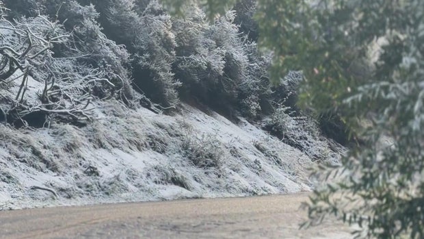
A winter weather advisory was in effect through 4 p.m. on Wednesday for areas above 3,000 feet in the Eastern Santa Clara Hills and portions of the Central Coast, with snow accumulations ranging from 4 to 10 inches – and up to 15 to 25 inches in the highest peaks. The advisory also indicated that additional downed trees and power outages were possible.
The new storm system arriving on Wednesday evening will bring a more continuous period of rain to both the Bay Area and the Central Coast, the Weather Service said. Rain could become moderate to heavy at times overnight, with stronger winds and gusts of roughly 20-40 mph and possibly higher in exposed coastal and hilltop locations.
Meanwhile, along the coast, a high surf advisory remained in effect, with rough seas and large, pounding surf expected through at least Friday morning. People visiting the coast were warned to stay well back from the water, as large waves and strong rip currents can develop suddenly and sweep over rocks and jetties.
Forecasters said by the time skies clear Thursday night into Friday morning, temperatures in the region will approach record lows for the month, and additional cold weather advisories or warnings are likely, even with the expected sunshine, the Weather Service said.
Following the brief respite on Friday, additional systems are expected to bring renewed chances for rain across both the Bay Area and the Central Coast into the weekend and early next week, although temperatures won’t be as cold, according to forecasters.


