Arctic blast creating frigid conditions in part of US. What is it?

By CBS Bay Area
The frigid air in place across the eastern U.S. actually came from thousands of miles away and is a phenomenon known as an Arctic blast.
For this “Zoomin’ around with Zoe” segment, meteorologist Zoe Mintz focuses on the Arctic.
The region consists of an ocean and is largely surrounded by land from parts of Canada, Greenland, Finland, Iceland, Norway, Russia, Sweden and Alaska. It’s usually outlined by the Arctic Circle, an imaginary line that circles the North Pole.
Along and north of the area is where the sun does not set on the summer solstice, also known as the midnight sun, and does not rise on the winter solstice, polar night.
And directly at the North Pole, the sun only rises and sets once each year: There are six months of continuous daylight and six months of continuous night. Temperatures in the summer can range from 40 degrees to 80 degrees or more across the Arctic, and in the winter, there are some regions of Siberia where average January temperatures are lower than -40 degrees Fahrenheit.
There are strong upper-level winds rotating around the North Pole that normally keep all this cold air contained to the Arctic in the summertime, known as a stable polar vortex.
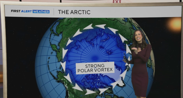
But in the winter, these upper-level winds weaken, and storms are able to send blasts of cold air directly from the Arctic south into the United States. So, it’s only when the polar vortex is weak in the winter, or disrupted by a storm, that Arctic air is able to head toward the U.S.
Now, the next time the words Arctic blast or polar vortex are mentioned, you know where that cold air is coming from and why.

